Pipeline Transport and How It Compares with Tankers
Pipeline transport is the movement of crude oil, refined products and natural gas over long distances through pipes. Types, how it works, cost, tanker comparison and lines through Türkiye.
Pipeline transport is the movement of fluids such as crude oil, refined products and natural gas over long distances through a system of pipes. It began in Pennsylvania in 1865, as a way of escaping what the wagon drivers charged to haul barrels. Today about 70% of crude and products in the United States moves by pipeline, 23% by ship, 4% by truck and 3% by rail. On 2014 figures, moving crude by pipe cost about $5 a barrel against $10 to $15 by rail.[2] Across an ocean the tanker wins. Türkiye sits where the two systems meet: Caspian oil reaches Ceyhan from Baku by pipe and goes on to the world by tanker.
The Teamsters and the Pithole Line
After the first commercial well at Titusville in 1859, output grew fast in Pennsylvania's Oil Creek region, but there was only one way of getting the oil out. Barrels went onto wagons and over muddy tracks to a railroad station or a creek. Teamsters charged more than $1 a barrel on short hauls and $4 or more on long ones. Crude could fall below 10 cents a barrel in the early years, and it averaged over $12 in 1864, so haulage often decided who made money.[1]
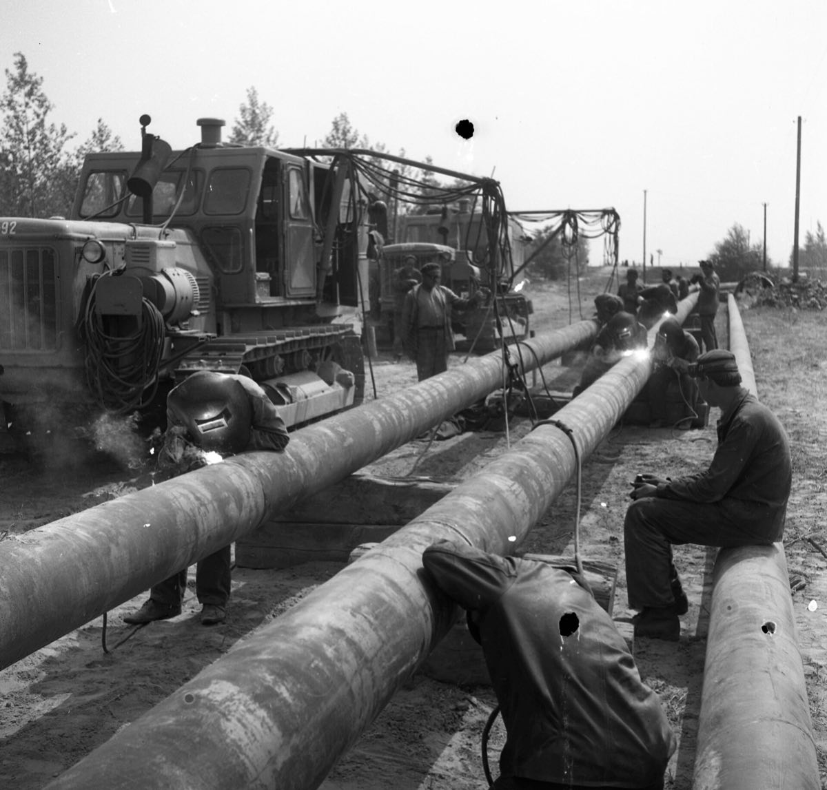
In 1865 the Pithole field was found southeast of Oil Creek, in woods with no roads. Samuel Van Syckel, an oil buyer in the district, saw his opening. Working from specifications by his engineer William Snow, he laid about 8 km of two-inch wrought iron pipe from Pithole to the Miller Farm railroad station. The pipe came in 15-foot joints, and part of it was buried two feet deep while the rest lay on the surface. The route had about 400 feet of relief.[1]
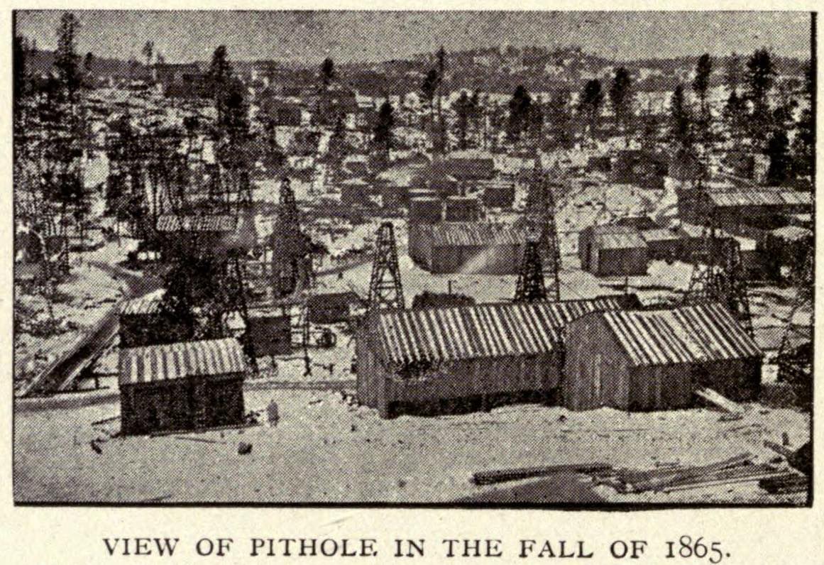
Three steam pumps started on 10 October 1865, moving 81 barrels an hour and about 2,000 barrels a day, at a charge of $1 a barrel. Other oilmen had laughed at the idea until the line worked. The teamsters who lost their living attacked it, and Van Syckel hired armed guards. In December he laid a second line and put up a telegraph along the route to keep track of shipments and faults. The success did not last for him personally. When two partners failed for unrelated reasons, the First National Bank of Titusville ran the lines until a debt of $15,000 was cleared. Van Syckel drifted out of the business and had more financial setbacks later.[1]
Tidewater and Standard Oil
At first pipelines stayed short. The railroads still took oil to distant refineries, and when Standard Oil bought Empire Transportation in 1877 it gained control of most pipe gathering and rail traffic. Independent producers and refiners went looking for another route. Byron Benson, Robert Hopkins and David McKelvy made a deal with Franklin Gowen, president of the Reading Railroad: they would pipe oil from Coryville in the new Bradford field to Williamsport, and Reading tank cars would take it on to Philadelphia and New York. Gowen covered $250,000, half the estimated cost.[3]
The Tide-Water Pipe Company laid its six-inch line between 22 February and 22 May 1879. It ran about 165 km (Yergin gives 110 miles, about 177 km), climbing some 1,200 feet over the Alleghenies and then descending by gravity. The builders even ran false surveys to mislead Standard. Oil reached the tanks at Williamsport on 4 June. Standard, caught off guard, quickly built four long lines to Cleveland, New York, Philadelphia and Buffalo. Within two years it was a minority shareholder in Tidewater, and the two agreed to pool shipments.[3][4]
Baku was working through the same problem. In 1878 the engineer Vladimir Shukhov, working for the Nobel brothers' company, piped oil from the Balakhani field to the refineries of the Black City district. Sources give the length as anywhere from 9 to 12 km. There too, the people put out of work were the cart drivers.[5]
The Big Lines That War Forced
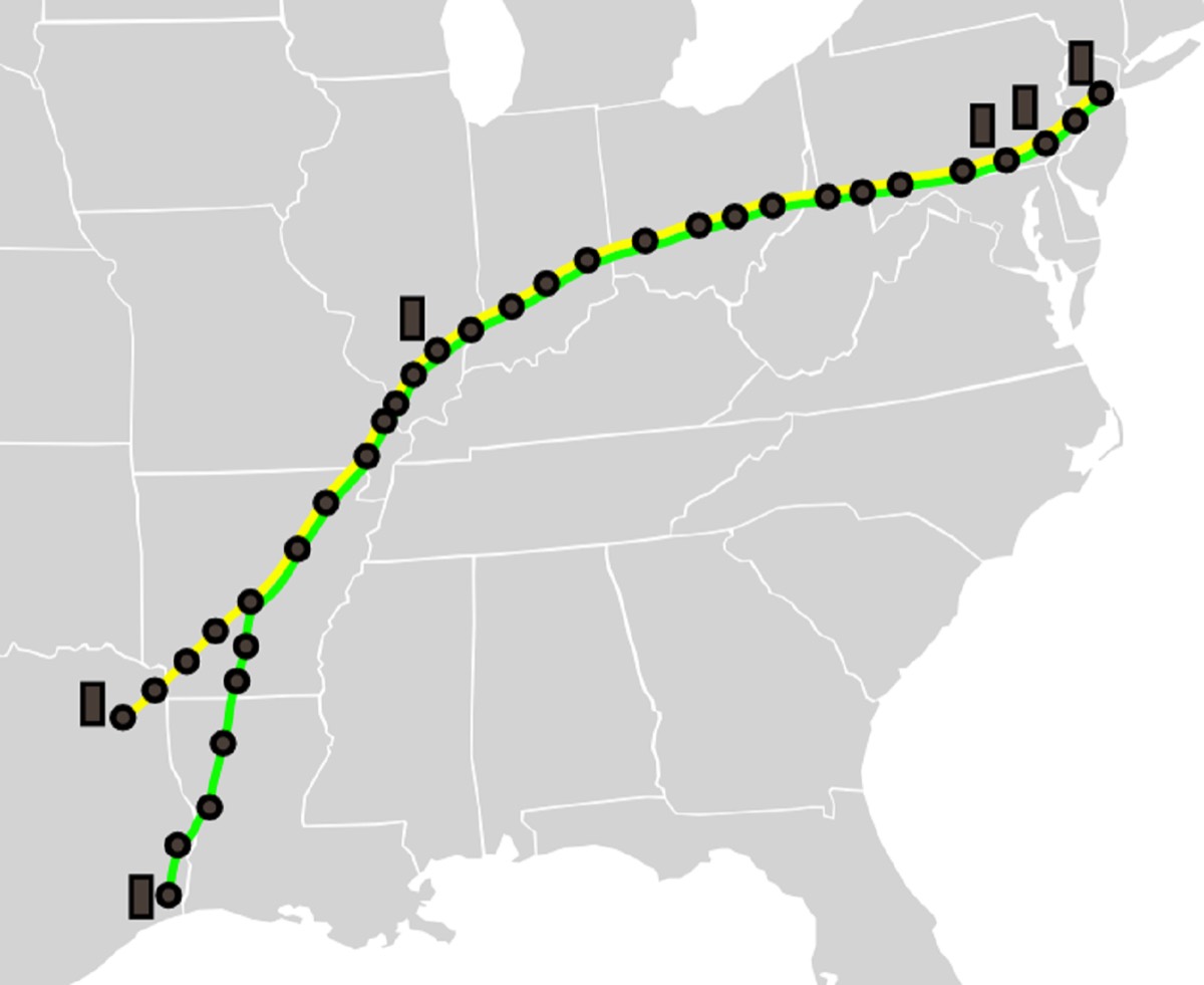
Pipelines on today's scale came with war. Until the Second World War, Texas oil reached the American northeast mainly by sea. When German submarines began sinking tankers in 1942, the Navy closed the route to them in April. Rail was costly and short of tank cars. The answer pushed by Interior Secretary Harold Ickes was two publicly funded lines. The 24-inch Big Inch ran 2,018 km from Texas to Pennsylvania and carried up to 334,000 barrels of crude a day, with first oil reaching Phoenixville on 14 August 1943. The 20-inch Little Big Inch ran 2,374 km and carried about 240,000 barrels of gasoline a day. After the war the government auctioned them, and Texas Eastern paid $143 million in 1947 and converted them to natural gas.[6]
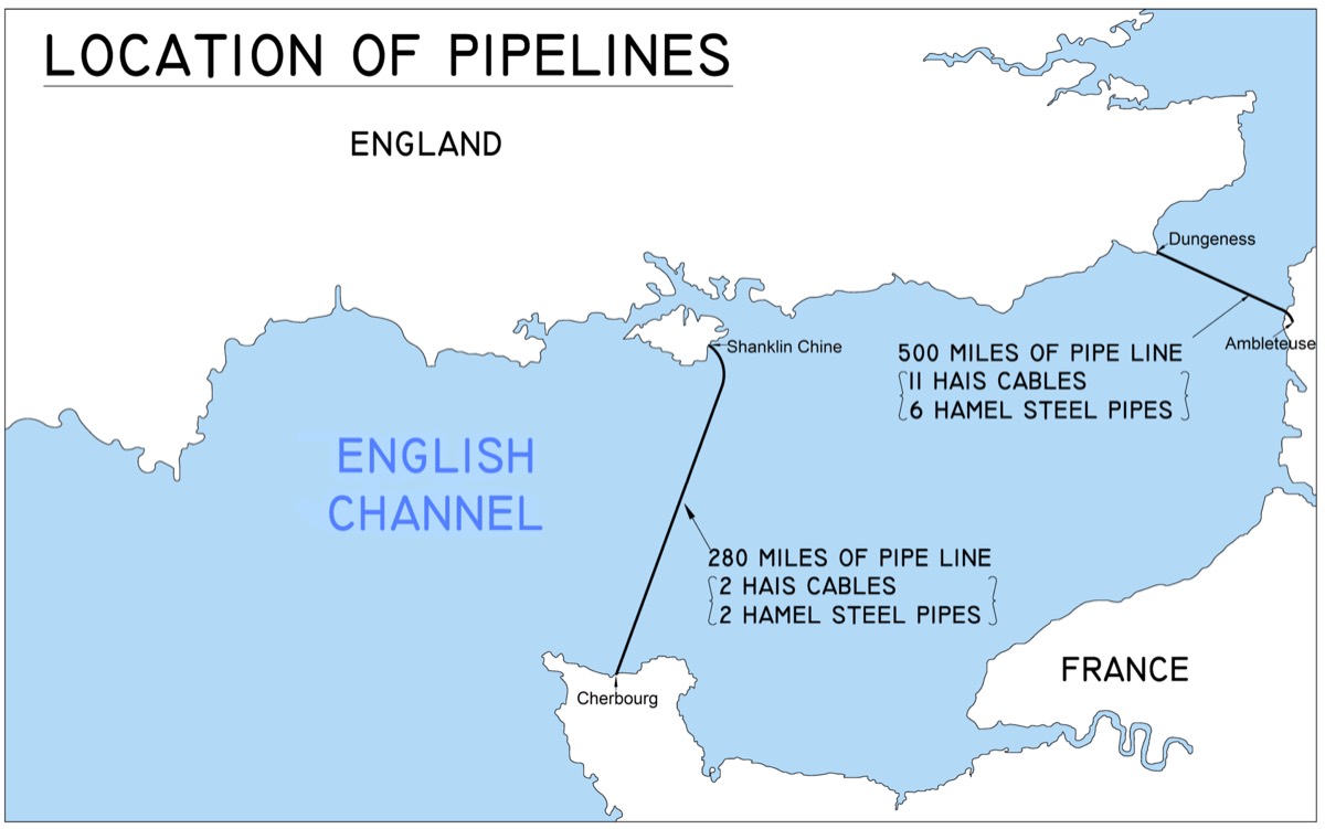
In Europe the same logic went under the sea. In 1944, after the Normandy landings, the Allies laid the PLUTO lines beneath the Channel. An estimated 8% of the petroleum products used on the Western Front up to the end of the war came that way.[2]
The Desert, the Soviet Bloc and Alaska
After the war the pipe became a geopolitical tool. Construction of the Trans-Arabian line began in 1947, to bring Saudi oil to the Mediterranean by a short route. It was meant to end at Haifa, but after the founding of Israel the route moved north across the Golan to Sidon in Lebanon. The 1,214 km line started in 1950. Transit fee disputes, breakdowns and competition from supertankers stopped the section beyond Jordan in 1976, and the rest closed completely in 1990.[7]
The Soviet Union wanted to tie the Eastern Bloc to it with oil. Comecon approved the Druzhba (Friendship) line in 1958, work began in 1960 and the whole line was running by October 1964. The system, over 4,000 km long, runs from Tatarstan to Germany, Poland, Hungary, Slovakia and the Czech Republic. It is still caught up in politics. Germany stopped Russian oil in January 2023, Russia stopped supplying Poland in February 2023, and an attack in January 2026 halted flows to Hungary and Slovakia until April.[8]
In Alaska the obstacle was geography. Atlantic Richfield found oil at Prudhoe Bay in 1968, estimated at over 25 billion barrels, but ice surrounded the field. The tanker Manhattan tried the Northwest Passage in 1969, took water in a cargo hold, and the sea route was judged too risky. The pipeline proposal then ran into environmental and Native land claims, and a federal judge stopped work in April 1970. The 1973 crisis broke the deadlock. Nixon signed the authorisation act on 16 November 1973, and the line, which cost over $8 billion, started up in 1977.[9]
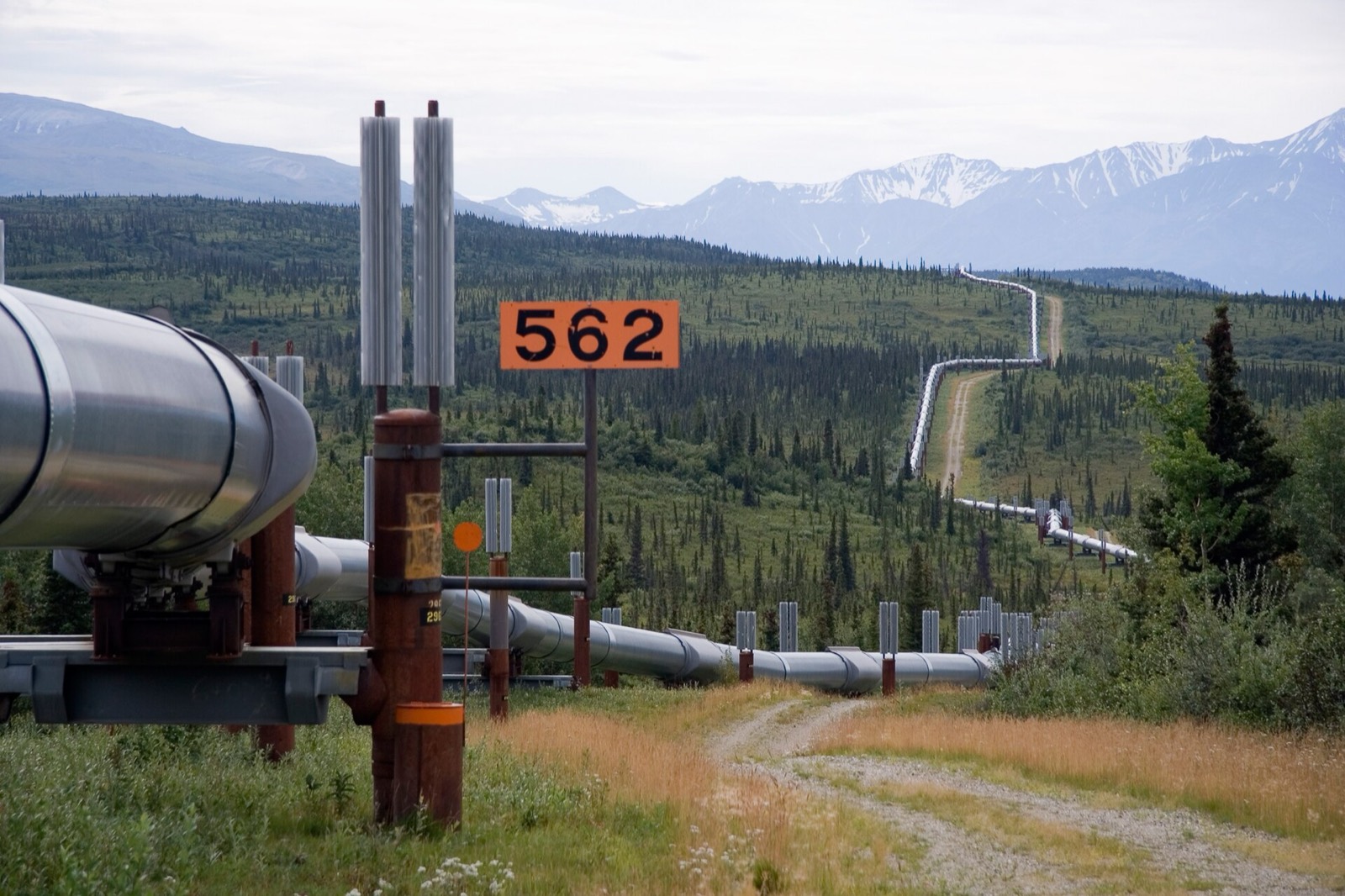
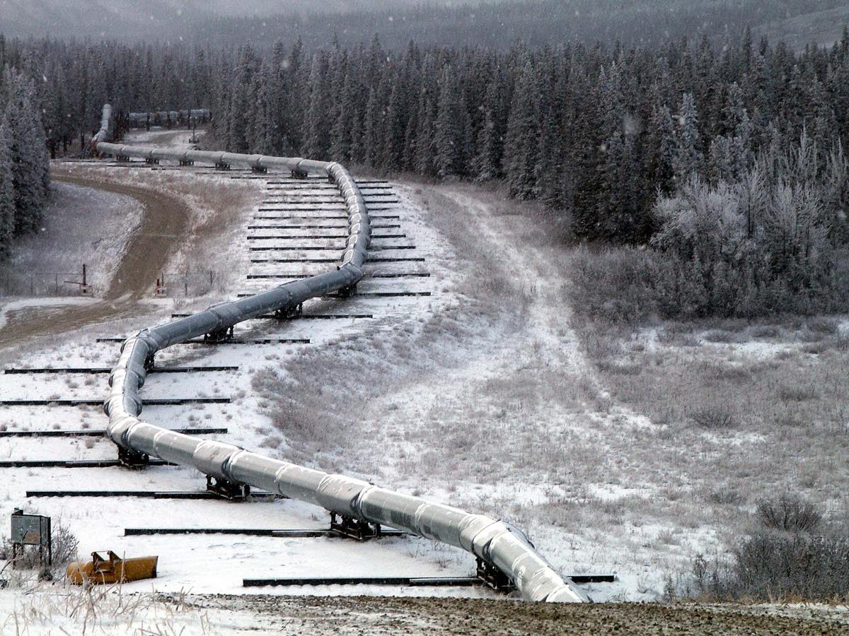
It runs 1,288 km from Prudhoe Bay to the port of Valdez in 48-inch pipe. The oil comes out of the ground at about 49°C, so long sections sit above the frozen ground on sliding supports to keep from thawing it. That design was tested in 2002. The magnitude 7.9 Denali earthquake moved the ground about 14 feet at the fault crossing. The supports had been designed for 20 feet, so the pipe held, and the line was shut for a little over 66 hours.[9]
Types of Pipeline
Pipelines fall into three groups by function. Gathering lines bring oil or gas from nearby wells to a processing plant and are short and small. Transmission lines cover long distances, cross borders, and are made of large-diameter steel. Distribution lines reach the end user in cities and make up the longest part of the gas network. Offshore, flowlines connect wellheads to a platform and export lines take the product ashore. US figures for 2023 give the scale.
| US pipeline type (2023) | Miles | Share |
|---|---|---|
| Gas distribution | 2,350,258 | 71.2% |
| Gas gathering | 378,242 | 11.5% |
| Gas transmission | 298,851 | 9.1% |
| Hazardous liquid transmission (crude, products) | 225,637 | 6.8% |
| Hazardous liquid gathering | 40,635 | 1.2% |
Most of the 3.3 million miles are gas pipes under neighbourhood streets. According to the Congressional Research Service, the roughly 225,000-mile crude and product network carries more than 83% of those goods in the United States.[10] That figure and the 70% at the top come from different calculations, so any single percentage can mislead.
How a Pipeline Works
Friction steadily reduces pressure, so pump stations on liquid lines and compressor stations on gas lines raise it again at intervals. Crude lines generally run from 4 to 48 inches in diameter and gas lines from 2 to 60.[2] To slow rust the outside is coated, and cathodic protection is added, meaning a small electric current is applied to the steel.
Flow speed depends on how full the line is. On Trans-Alaska, a trip end to end took about 4.5 days in 1988, when flow was around 2 million barrels a day. As volumes fell, it stretched to about 18 days by 2018.[9] That works out as a fall from about 12 km an hour to about 3 km an hour.
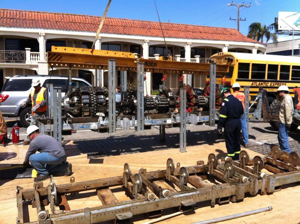
Product lines also have to manage sequence. Gasoline, diesel and jet fuel can travel in batches through the same pipe, and where batches meet they mix, so that portion is handled separately. Crude drops paraffin wax in the cold and the bore gradually narrows. Devices called pigs are sent down the line to deal with this. Cleaning pigs scrape the wall, and smart pigs scan from the inside for dents, metal loss and cracks. They go in at one pig station and come out at another.[2]
Pipelines Compared with Tankers
On land, with steady long-term volumes, pipe wins. The investment is heavy at the start, but running costs and labour are low. Once laid, the route and customer are fixed too, so big lines are usually financed against long-term transport contracts. The tanker's strength is flexibility. The same ship can go to Asia this month and Europe next month, and if freight falls it can change route. Laying pipe on the deep seabed is hard and expensive, which is why transoceanic oil trade has stayed with tankers.
For gas the decision turns on distance and volume. Pipe is cheap over short distances, and over long ones it may make more sense to liquefy the gas and carry it by LNG tanker. The break-even varies by project and cannot be reduced to one distance.
Lines Through Türkiye
Türkiye's first big line is Kirkuk-Ceyhan, which brings Iraqi oil to the Mediterranean. It stopped in March 2023 after an international arbitration ruling and reopened on 27 September 2025. The old treaty between the two countries expired at the end of July 2026, and BOTAŞ and the Iraqi side signed a one-year interim deal. It reserves 750,000 barrels a day of capacity, while actual flow in August 2026 was between 170,000 and 200,000 barrels a day.[11]
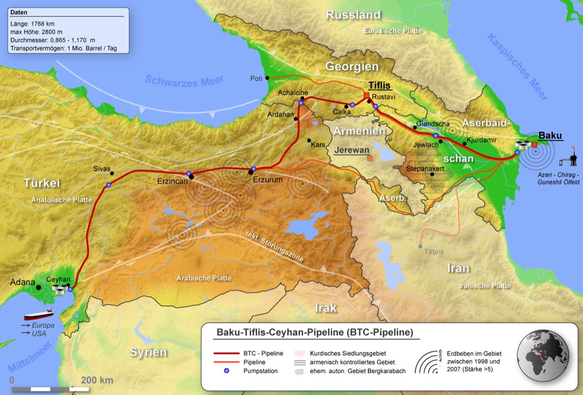
The Baku-Tbilisi-Ceyhan (BTC) line exists because the Caspian is landlocked. In Soviet times all the region's oil routes ran through Russia. After the collapse, Azerbaijan looked for another outlet. Türkiye proposed a route through its territory in 1992, the Nagorno-Karabakh conflict ruled out Armenia, and the longer route through Georgia was chosen. Construction began in April 2003 at a cost that reached $3.9 billion, and oil arrived at Ceyhan on 28 May 2006. The first cargo of about 600,000 barrels left on the tanker British Hawthorn on 4 June. Operatorship passed from BP to SOCAR on 1 July 2026.[12]
| Line | Route | Length | Capacity |
|---|---|---|---|
| Baku-Tbilisi-Ceyhan (BTC) | Azerbaijan, Georgia, Türkiye | 1,768 km (1,076 km in Türkiye) | 1 to 1.2 million barrels a day, by source |
| Kirkuk-Ceyhan | Iraq, Türkiye | About 970 km | About 1.5 million barrels design, far less in practice |
| TANAP | Georgian border to Edirne | About 1,850 km | 16 bcm a year, expandable to 31 |
| TurkStream | Russia, Black Sea, Thrace | 930 km offshore section | 31.5 bcm a year |
This is why Ceyhan matters. Caspian oil arriving by BTC loads onto tankers in the eastern Mediterranean and reaches the market without entering the Straits. The line removed about 350 tanker cargoes a year from the Istanbul Strait and the Dardanelles.[12][13] Here the pipeline stops being the tanker's rival and becomes the link that supplies it with cargo.
On gas, TANAP and TurkStream made Türkiye part of the route to Europe as well as a consumer. TANAP opened in 2018 and carries Azeri gas as the middle link of the Southern Gas Corridor, and TurkStream started in January 2020.[14]
Lines That Bypass Hormuz
When war with Iran began at the end of February 2026 and the exit from the Persian Gulf largely closed, Gulf oil had to go around the strait. The route ready for that was Saudi Arabia's East-West line, built in 1981. Running about 1,200 km from the eastern fields to Yanbu on the Red Sea, it reached its maximum of 7 million barrels a day on 28 March 2026.[15] Two problems followed. Houthi attacks made the Red Sea difficult, and Kpler put flow at about 2 million barrels a day in August. In early September drones struck the line, closing it for five or six days. The Saudi energy minister said in early October that flow was back at 5.8 million barrels a day.[15]
The UAE's 1.8 million barrel line to Fujairah is the second exit.[16] That capacity is small against the 20 million barrels a day that normally pass the strait, but these lines are the only buffer available in a crisis. Qatari LNG has no such route. The Red Sea episode also showed that a line is not enough by itself, because oil arriving by pipe still needs a safe way out of the port.
Risk and Safety
Pipelines are considered safer than trucks and rail. In the United States between 2014 and 2024, pipeline incidents killed an average of 11 people and injured 48 a year.[10] Scale still matters when things go wrong. The 2010 Enbridge spill in Michigan polluted the Kalamazoo River. The newer risks are cyber and military. In May 2021 a ransomware attack stopped the 5,500-mile Colonial Pipeline, which carries fuel to the US East Coast, for several days and caused queues at filling stations. On 26 September 2022 the Nord Stream lines under the Baltic were blown up.[2]
Oversight varies by country. In the United States the federal agency PHMSA is responsible for onshore pipeline safety, with states inspecting more than 85% of the infrastructure.[10] Building new lines in North America is slowed by years of litigation. The best-known case is Keystone XL, which ended when its permit was revoked in 2021.
Frequently asked questions
What is pipeline transport?
Pipeline transport is the movement of fluids such as crude oil, refined products and natural gas over long distances through a system of pipes.
What are the advantages and disadvantages of pipeline transport?
On land, with steady long-term volumes, running costs and labour are low. The initial investment is very high, however, and once the pipe is laid the route and customer are fixed. Across oceans the tanker is used for that reason.
When was the first oil pipeline built?
The first successful one was the line of about 8 km that Samuel Van Syckel ran between Pithole and Miller Farm in Pennsylvania in October 1865. The first long-distance line was Tidewater in 1879.
How fast does oil move through a pipeline?
It depends on flow. On Trans-Alaska the 1,288 km journey took about 4.5 days in 1988 and about 18 days in 2018, after volumes fell.
How much pipeline is there in the world?
Counts vary with what is included. Industry figures put the main transmission network at about 2.19 million km in 2025, with about 44% in North America. Local gas distribution is not included.
Are pipelines used for marine fuel?
Yes. Fuel generally reaches depots and port terminals from the refinery by pipe. From there it goes to a barge or directly to the ship, which is covered on the bunker trading page.
Sources
- Petroleum History Institute. Samuel Van Syckel and the First Pipeline.
- Wikipedia. Pipeline Transport.
- Wikipedia. Tidewater Oil Company.
- Daniel Yergin. The Prize: The Epic Quest for Oil, Money, and Power, chapter 2, 1991.
- Russkiy Mir. Proud of Our People! Vladimir Shukhov; Forpost, Designer of Russia's First Oil Pipeline, 21 December 2021.
- Wikipedia. Big Inch.
- Wikipedia. Trans-Arabian Pipeline.
- Wikipedia. Druzhba Pipeline.
- Wikipedia. Trans-Alaska Pipeline System.
- US Congressional Research Service. DOT's Federal Pipeline Safety Program, R44201.
- Arab News; Global Energy Monitor, Kirkuk-Ceyhan Oil Pipeline; Enerdata, 4 August 2026.
- Wikipedia. Baku-Tbilisi-Ceyhan Pipeline.
- BP Azerbaijan. Baku-Tbilisi-Ceyhan Pipeline.
- TurkStream project page; Pipeline & Gas Journal, December 2019.
- Bloomberg, 28 March 2026; Al Jazeera, Saudi Arabia Says East-West Pipeline Pumping 5.8 Million BPD, 6 October 2026.
- US Energy Information Administration (EIA). Amid Regional Conflict, the Strait of Hormuz Remains Critical Oil Chokepoint, 16 June 2025.